Hunter Regional Trails (HRT)
Introduction
Welcome to the Hunter Regional Trail (HRT) vision! Slowly but surely creating an 11-mile trail corridor to connect Kaaterskill Falls in Haines Falls to Dolan’s Lake in the Village of Hunter is coming to fruition. Under the guidance of the Hunter Area Trail Coalition (HATC), the vision to connect 11 miles of trails through public and private lands from Kaaterskill Falls and the New York State North South Lake Campground to the Village of Hunter into a cohesive trail network throughout the Town of Hunter and its two incorporated Villages, Tannersville and Hunter, is coming together piece by piece. Join the HATC in Celebrating Trails Day on April 22, 2023 as another section is added to the system!
HRT Phase 5
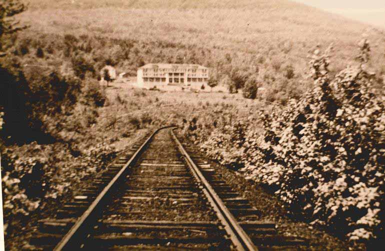
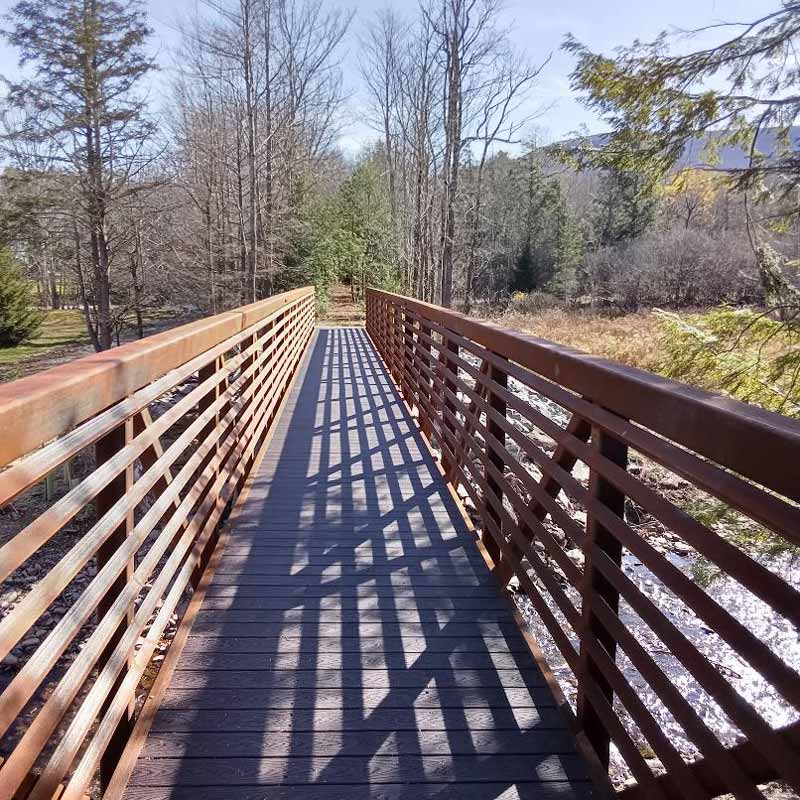
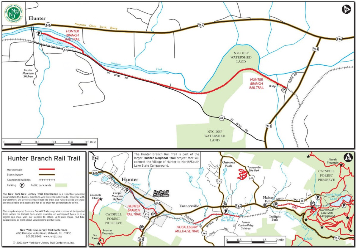
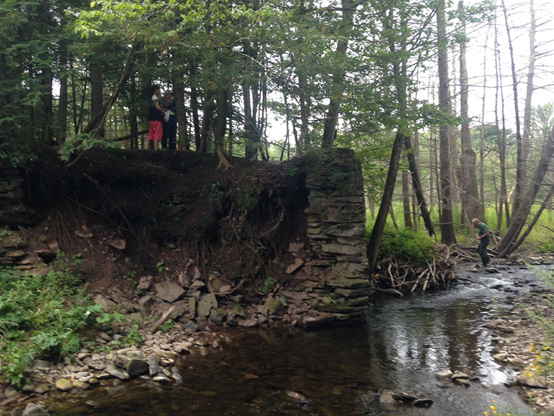
On April 22, 2023, the Hunter Area Trail Coalition will host a bridge opening on the Hunter Branch Rail Trail (HBRT). The last segment of the HRT, the HBRT connects Clove Road off State Route 214 to Dolan’s Lake in the Village of Hunter. At just under a mile in length, the HBRT was the northern terminus of the Hunter Branch of the Stony Clove and Catskill Mountain Railroad, which was discontinued in 1939. The completion of Phase 5 includes the installation of a 90 foot long pedestrian bridge where the railroad was once carried over a small Schoharie Creek tributary—to that end, a section of the original stone abutments has been left in place for visitors to appreciate the efforts of early railroad workers.
The Hunter Branch railroad of the Ulster and Delaware Railroad was originally built as a narrow gauge railroad from Phoenicia on the Delaware & Hudson line from Kingston. Work began at the Phoenicia end in 1881 and was completed a year later to the Hunter terminal. The railroad from the beginning had a profitable freight business from the numerous saw mills and furniture factories in the Stony Clove Valley to the south and Hunter Village, then a commercial hub for the industries and farms in the upper Schoharie Valley. New York City Department of Environmental Protection owns the parcel and issued a land use permit to the Town of Hunter. The total length of phase 5 is approx. 1.4 miles between Clove Road and the Village of Hunter at Dolan’s lake.
HRT Phase 1 – Kaaterskill Rail Trail (KRT)
committee called KRT committee formed in 2009 after the completion of a mountaintop recreation planning project, Mountaintop Community Resource Strategy. The committee prioritized the Ulster & Delaware railroad between the Mountain Top Historical Society (MTHS) and Kaaterskill Falls on NYSDEC land as its first trail project. Partner agencies involved the effort included the NYSDEC, the Town of Hunter, the MTHS, the Catskill Center for Conservation and Development, Greene County Soil and Water Conservation District, and the New York-New Jersey Trail Conference.
Developing the former rail bed into a public trail was envisioned for many years. Thanks to the participation of the property owners allowing the trail, and to the not-for-profit organizations and government agencies working together, the KRT officially opened on National Trails Day in June 2013. It offers amazing views of the popular Kaaterskill Falls and provides an important link between the Mountain Top Historical Society and the facilities at the NYS North South Lake campgrounds, dispersing visitors and relieving traffic congestion along Route 23A.
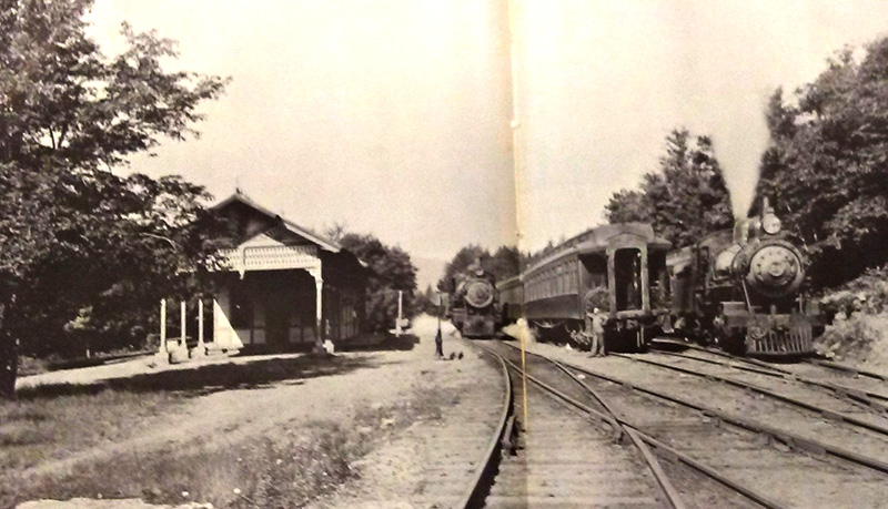
Kaaterskill Station circa 1880s
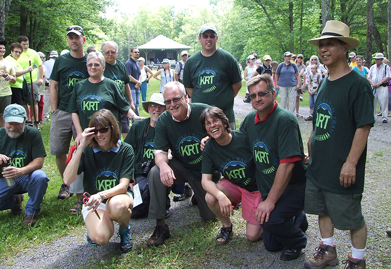
KRT Volunteers during the June 2013 opening
When the KRT initially opened in June 2013, trail easements were executed with three property owners allowing the trail to open with a detour around one property. Four years later in 2017, the trail opened with a direct route along the historic railbed from the Mountain Top Historical Society to Laurel House Road at 1.5 miles completing phase 1.
The rail trail leads to many other trails on NYSDEC land around the popular North South Lake State Campgrounds including the Escarpment Trail, the former site of the Catskill Mountain House and a trail around South and North Lakes for leisurely strolls. It roughly follows what was originally a footpath dating back to the 1820s that connected the Catskill Mountain House to hotels in Haines Falls.
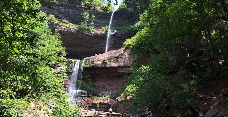
Kaaterskill Falls
On both sides of the KRT is the Mountain Cloves Scenic Byway, the first state designated scenic byway in the Catskill Park. To the north is North Lake Road (County Route 18), which leads to the North South Lake State Campground, and to the south is State Route 23A, the gateway to the northern Catskill State Park.
HRT Phase 2 – Kaaterskill Wild Forest recreation enhancements
Phase 2 of the HRT network entails safety and public access improvements on New York State land in the Kaaterskill Wild Forest. Following the success of opening the KRT in 2013, the NYSDEC invested close to $1million in and around Kaaterskill Falls to make access safer and more manageable.

Opening of the DEC Viewing Platform overlooking Kaaterskill Falls – September 2018
Improvements included: 1) installing a 115-foot pedestrian bridge over Spruce Creek above Kaaterskill Falls on what was once a carriage trail that brought tourists to the Hotel Kaaterskill and Catskill Mountain House; 2) constructing a new foot trail leading from the end of the marked Kaaterskill Falls trail at the base of the falls upslope to the middle pool of the falls; 3) installing a stone staircase designed to blend in with the natural stone of the area at a location that limits its visibility from below; 4) expanding two parking areas; 5) constructing an observation platform overlooking the top of the falls and 6) building new, wide, smooth surface trails with level resting areas. A celebration was held on September 13, 2017 at the top of Kaaterskill Falls to promote trail safety during the busy hiking season. Over 125 people attended including state, county, and local officials, as well as numerous trail and regional organizations.
HRT Phase 3
This phase will connect the KRT 1 at the Mountain Top Historical Society in Haines Falls to the Huckleberry Multi-Use Trail in Tannersville. Three landowners have agreed to the allow the trail and pedestrian access agreements have been executed with the Town of Hunter. The Town of Hunter was awarded a $75,000 NYSDEC Smart Growth grant to advance planning on the north side of Route 23A (the “sidewalk connector”) and to begin trail construction on two properties.
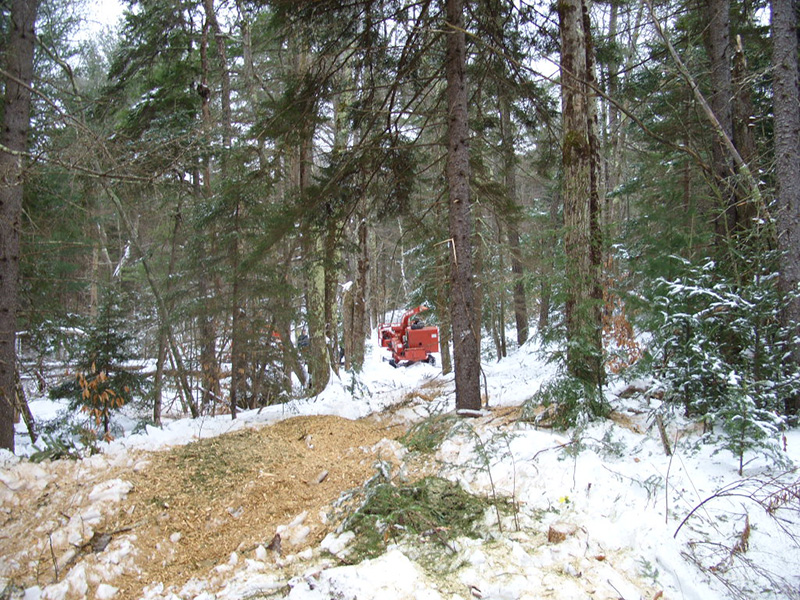
Creating the Phase 3 trail through the Cortina Mountain Estates (January 2018)
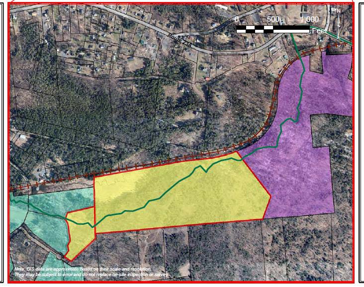
HRT Phase 3 (above)
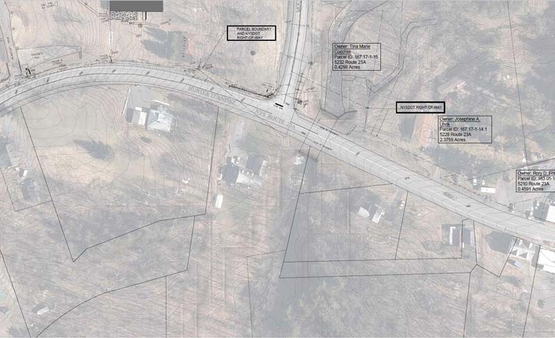
HRT Phase 3 sidewalk connector bridging north side and south side of Route 23A
HRT Phase 4
Also part of the former Ulster & Delaware Railroad, this section of rail line remains intact for the most part. This phase would require a long pedestrian bridge over the Schoharie Creek at the former electric light dam. The bridge would require extensive permitting and fundraising. An alternative is to work with NYSDOT on designating State Routes 214 and 23A as share the road with pedestrians.
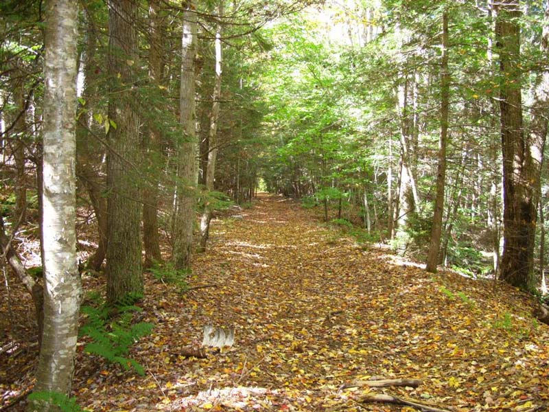
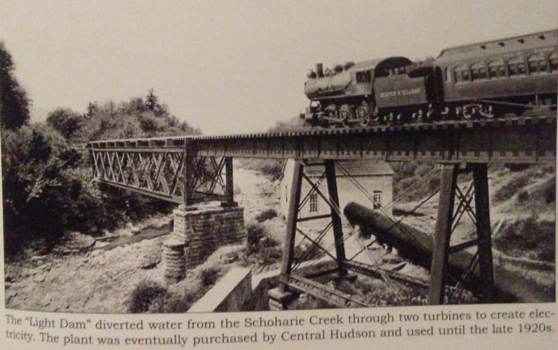
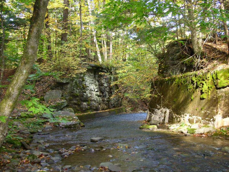
Stone abutments from the railroad era are still intact along HRT Phase 4
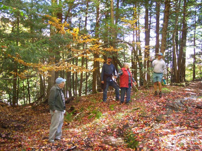
HATC members scouting the railbed for HRT Phase 4
HATC and Partners
HATC forms
The early KRT committee formed into the Hunter Area Trail Coalition (HATC) in 2016 as it expanded the planning efforts on future trail extensions to the Village of Hunter. The HATC currently is implementing this multi-phase network of trails throughout the Town of Hunter. The goal is to coordinate trail planning projects and leverage resources that build upon the vision of creating a cohesive town-wide trail network that connects public and private lands for year-round outdoor recreation.
Representing local government, state, city and county agencies and local not-for-profit organizations, the HATC plans and collaborates on trail projects that enhance hiking opportunities within the town. Participating members include Catskill Center for Conservation and Development, The Hunter Foundation, Greene County Soil & Water Conservation District/Watershed Assistance Program, Mountain Top Arboretum, Mountain Top Historical Society, NY-NJ Trail Conference, NYC Department of Environmental Protection, NYS Department of Environmental Conservation, Town of Hunter, Village of Hunter, Village of Tannersville, and Windham Area Recreation Foundation.

